
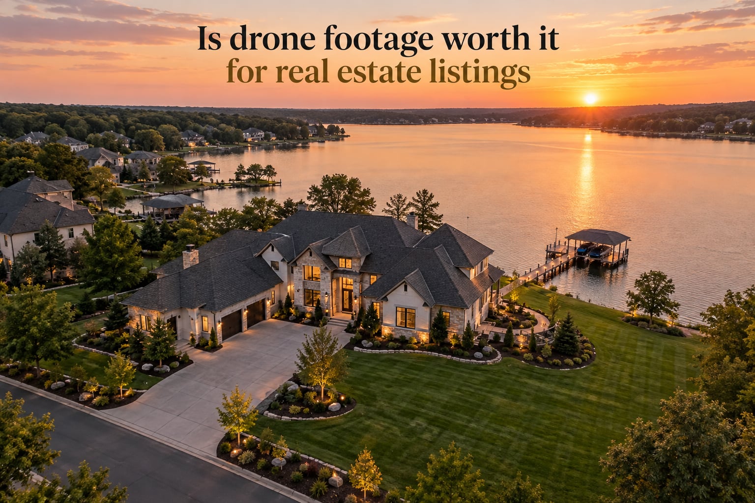
Yes, drone footage is worth it for real estate listings when the property has land, views, location context, or architectural character buyers can’t appreciate from the ground. Industry data shows homes marketed with aerial photos sell roughly 68% faster and earn up to 94% more listing views than listings with ground photos alone. For a standard home on a tight city lot, drone footage adds less value and the cost may not pay off.
I work with sellers and agents every week who ask the same question: will spending money on aerial photography actually move the needle on my listing? After comparing dozens of drone and non-drone listings across price tiers in 2026, here’s the honest answer, the numbers behind it, and the exact scenarios where drone footage does and doesn’t make sense.
Table of Contents
- Quick Answer: Is Drone Footage Worth It for Real Estate Listings?
- What Drone Footage Actually Does for a Listing
- The Real Numbers: How Drone Footage Affects Sale Speed and Buyer Engagement
- When Drone Footage Is Worth It: Property Types and Price Tiers
- When to Skip Drone Footage
- How Much Does Drone Footage Cost?
- FAA Rules, Licensing, and Legal Basics
- Drone vs Ground Photos vs Virtual Tour
- Hiring Checklist: How to Pick a Real Estate Drone Operator
- How to Get Into Drone Photography for Real Estate (Side Hustle Path)
- Frequently Asked Questions
- How much do realtors pay for drone footage?
- Do drone photos help a house sell faster?
- Do I need a license to fly a drone for real estate?
- Are drone photos worth it for small homes?
- Will real estate photography be replaced by AI?
- Can you make money selling drone footage?
- What kind of property needs drone photography?
- The Bottom Line on Whether Drone Footage Is Worth It
Quick Answer: Is Drone Footage Worth It for Real Estate Listings?
Drone footage is worth it for real estate listings whenever the property’s value is tied to something a buyer can’t see at street level – lot size, layout, surrounding land, water, views, or neighborhood context. For those listings, drone footage typically cuts days on market by more than half and drives substantially more qualified showing requests.
The flip side: for a small infill home on a tight lot, a downtown condo, or any listing where the roofline and front yard are basically the whole story, drone footage rarely justifies the shoot cost. The buyer clicks past it, and you spent money you didn’t need to.
What Drone Footage Actually Does for a Listing
Drone footage gives buyers a perspective no ground camera can deliver. A licensed drone operator flies a small unmanned aircraft above and around the property to capture establishing shots, slow orbits, top-down reveals, and push-ins toward the home.
From that altitude, a buyer can see things they’d otherwise need to drive past the property to notice:
- Lot size, shape, and how the home sits on the parcel
- Distance to neighbors, streets, and natural features
- Backyard privacy and outdoor living space
- Neighborhood context – parks, water, schools, downtown proximity
- Architectural character of the home from above (roofline, pool, additions)
Most buyers decide whether to schedule a showing in the first 5-10 seconds of viewing a listing. Drone footage delivers the context shot that grounds the interior photos and answers the silent question every buyer has: “What’s actually around this house?”
The Real Numbers: How Drone Footage Affects Sale Speed and Buyer Engagement
The numbers below are the most widely cited across the industry and were repeated in NAR, MLS, and major photography platform data through September 2026. They reflect what happens when listings include aerial imagery compared to listings with ground photos only.
Here are the headline stats:
- 68% faster sales – properties with aerial photos move through the market faster than comparable listings without aerial coverage (cited across NAR-aligned reporting and multiple MLS studies)
- 94% more views – listings with rich media, including drone footage, earn dramatically more impressions than text-and-photo listings
- 65% more showings – aerial imagery correlates with a higher rate of qualified buyers requesting in-person tours
- 40x more social shares – drone clips are shared far more often than static photos on platforms like Instagram, Facebook, and TikTok, where most buyers start their home search today
- 52% of REALTORS use drone photography or video – the 2025 NAR REALTOR Technology Survey shows drone adoption has crossed the halfway mark among working agents
A realtor posting on r/realtors shared what their workflow looks like: “I usually do about half a dozen drone shots for my listings. Show the property from the front and back. Usually one or two with the boundary lines.” That kind of focused shot list tends to deliver the most engagement without burning the budget.
When Drone Footage Is Worth It: Property Types and Price Tiers
Drone footage pays off most clearly on listings where the land, location, or architecture is part of what the buyer is paying for. Here are the property types where aerial imagery consistently moves the needle.
Luxury homes and high-end listings: Buyers in the luxury segment expect polished marketing, and drone footage is now table stakes. An establishing aerial shot of the estate, the grounds, and the surrounding neighborhood sets the tone before the buyer ever steps inside.
Waterfront homes: A drone is the only practical way to show the shoreline, the dock, the swim area, and how the home relates to the water. Ground photos capture the view from the deck; drone footage shows the full lakefront or beachfront context.
Large acreage, equestrian, and rural properties: Buyers can’t tell if a 12-acre property has usable land, outbuildings, or road frontage from ground photos alone. A top-down or orbit shot answers all of those questions in a single frame.
Hillside, sloped, and architecturally distinctive homes: A multi-story home on a slope, a modern build with an unusual roofline, or any property where the architecture is the selling point benefits from an aerial angle. Drone shots show the elevation and the design in a way no front-yard photo can.
Golf course, country club, and resort-adjacent properties: Proximity to amenities drives value here. Drone footage proves the lot backs up to the fairway or the clubhouse is a short walk away – context buyers actively look for.
New construction and vacant land: For homes not yet finished or empty lots, drone footage is often the only way to communicate “this is what the finished project will look like in its setting.” It’s also the cleanest way to show lot boundaries, road access, and neighborhood context.
Listings targeting out-of-town buyers: When a significant share of the buyer pool is relocating from another city or state, aerial footage reduces uncertainty about the surrounding area. Buyers who have never visited the neighborhood use drone shots to confirm the location matches their expectations.
When to Skip Drone Footage
Drone footage is not a universal upgrade. There are several common listing scenarios where the cost doesn’t pay off and traditional photography is enough. Most competitor articles skip this section, so sellers end up over-spending on aerial shoots they didn’t need.
Small urban lots and infill homes: If the home sits on a 0.1-acre lot with a neighbor on every side, the drone doesn’t add information. The buyer can see the lot size from the street view and a regular MLS photo. Save the budget for staging and twilight interior shots.
Condos and townhomes with shared amenities: Once you’re inside a building or community, the drone can’t show much. Pool, gym, and rooftop amenity photos come from ground-level or interior photography. Skip the drone for the unit itself.
Standard tract homes in cookie-cutter subdivisions: If every home on the street looks like the listing, the drone footage of the neighborhood isn’t doing much. Focus on interior photography, floor plan, and a strong listing description.
Tight HOAs with privacy rules: Some HOAs restrict drone flights over common areas or neighboring homes. If the operator can’t get clean angles without flying over private property, the deliverable suffers and you may be dealing with a complaint.
Properties in restricted airspace: Homes near major airports, military bases, or national parks often require LAANC authorization or are off-limits to small drones. The shoot can be cancelled on short notice, rescheduling headaches pile up, and you may end up with no aerial footage at all.
Wind, weather, and shoot-day risk: Drone shoots get cancelled for wind, rain, low ceiling, and golden-hour timing more often than ground shoots. If the listing has a tight marketing window, that risk matters.
How Much Does Drone Footage Cost?
Real estate drone photography pricing varies by market, but the ranges below came up repeatedly across r/RealEstatePhotography, MavicPilots, BiggerPockets, and GrassrootsMotorsports forums in 2026.
- Shoot only (raw files, no editing): roughly $150-$300 per property
- Shoot plus edited stills (10-15 high-resolution aerial photos): roughly $400-$750 per property
- Shoot plus edited stills plus a 30-90 second aerial video clip: roughly $600-$1,000 per property
- Bundled with ground photography and virtual tour: roughly $800-$1,500 per property
A photographer posting on MavicPilots noted: “Ground photography typically ranges from $100 to $400, depending on number of photos, editing, virtual tours or 3D walkthroughs.” Add the drone component on top of that and you’re typically in the $400-$750 total range for a full aerial package with edited stills.
The pricing inconsistency frustrates a lot of buyers. Some sellers pay $150 for a basic drone add-on; others pay $750+ for a luxury shoot with twilight aerials and a video deliverable. The difference usually comes down to the operator’s experience, the amount of post-processing, and whether video is included.
For most listings, expect to budget for a $400-$750 drone package if you want both edited stills and a short video clip. That’s the most common quote sellers report receiving across the U.S.
FAA Rules, Licensing, and Legal Basics
If you hire a drone operator for real estate work, you are hiring someone flying commercially. That means they need an FAA Part 107 Remote Pilot Certificate, drone registration, and the right to fly in your area. Here’s what matters.
FAA Part 107 Remote Pilot Certificate: Anyone flying a drone for compensation – including real estate shoots – needs a Part 107 certificate. The test covers airspace, weather, sectional charts, and operational rules. Passing it requires studying, but most operators clear it within a few weeks.
Drone registration: Every commercial drone flown under Part 107 must be registered with the FAA. Unregistered drones can trigger civil penalties up to $27,500 and criminal penalties up to $250,000 per violation, so this is not a corner to cut.
Remote ID compliance: As of recent FAA rules, drones must broadcast Remote ID information. Any operator you hire should be flying compliant hardware.
LAANC airspace authorization: For properties inside controlled airspace (often within 5 miles of an airport), the operator needs LAANC authorization before the shoot. This is automatic for Part 107 pilots but it adds lead time.
Insurance: Most working real estate drone operators carry $1 million or more in liability insurance. Confirm this before booking – if the drone damages the property or injures someone, you want coverage in place.
If you plan to fly your own drone for your listing, the same rules apply. Doing it without a Part 107 certificate is technically a federal violation even if you’re the homeowner, because the imagery is being used to market a home sale.
Drone vs Ground Photos vs Virtual Tour
Each marketing medium has a different role, and the strongest listings use all three in the right balance. Here’s how they compare for the typical real estate shoot.
| Medium | Best for | Typical cost | Limits |
|---|---|---|---|
| Drone footage and aerial stills | Showing land, location, neighborhood context, luxury, waterfront, acreage | Included in $400-$750 packages | Wind, airspace, no-fly zones, no interior coverage |
| Ground photography and twilight stills | Interior rooms, finishes, layout, curb appeal from street level | $150-$400 typical | Limited lot context, no neighborhood overview |
| Virtual 3D tour (Matterport and similar) | Buyers who want to walk through remotely, out-of-town relocations | $200-$500 typical add-on | No exterior context, slow loading on some browsers |
For most listings, the winning combination is a tight set of drone establishing shots plus polished interior photography and a floor plan. The virtual tour is optional but adds strong qualified-buyer filtering for higher-priced listings.
Hiring Checklist: How to Pick a Real Estate Drone Operator
Use this checklist before booking. A qualified drone operator checks every box; an unqualified one cuts corners on insurance, registration, or post-processing.
- Verify a current FAA Part 107 Remote Pilot Certificate (ask to see it).
- Confirm the drone is FAA-registered and Remote ID compliant.
- Confirm $1M+ liability insurance and ask for the certificate of insurance.
- Review a portfolio of at least 10-20 prior real estate shoots.
- Ask for a sample shot list (typically 8-15 aerial angles per property).
- Confirm deliverables: how many edited stills, video length, file format (RAW + JPEG is best), delivery timeline.
- Discuss airspace and LAANC authorization if the property is near an airport.
- Get a written contract covering copyright ownership, indemnification, and rescheduling for weather.
- Confirm post-processing style – ask for unedited samples to judge the source quality.
- Check turnaround time. Most operators deliver edited aerial stills within 48-72 hours.
One thing sellers often miss: copyright ownership. Make sure the contract specifies that you own the delivered images and video, not the photographer. This matters when the listing falls out of escrow and you relist with another agent.
How to Get Into Drone Photography for Real Estate (Side Hustle Path)
Drone real estate photography is one of the most accessible side hustles in the photography world. Here’s the path our community takes of operators who break into the market.
Step 1 – Get your FAA Part 107 certificate. Study the FAA’s free Part 107 study guide, take a practice test app, and schedule the exam at a local testing center. Most pilots pass within 4-8 weeks of starting to study.
Step 2 – Buy a capable drone. Entry-level real estate work is done well with current prosumer drones that shoot RAW stills and 4K video with gimbal stabilization. Used pricing has come down sharply over the last few years.
Step 3 – Practice on your own property first. Shoot your own home from 8-12 angles, edit the results, and build a portfolio before reaching out to agents.
Step 4 – Build a portfolio page. A simple website with 20-30 strong before-and-after examples is enough to start landing clients.
Step 5 – Reach out to local agents. Offer a discounted first shoot in exchange for portfolio rights and a review. Most new operators land their first 5-10 clients this way.
Step 6 – Get insured and registered. Liability insurance is affordable and most brokers require it before adding you to their vendor list.
Step 7 – Price competitively at first. Many new operators start at $200-$300 per shoot to build reviews, then raise pricing once they have steady demand.
On commercial drone pilot forums, working operators report steady demand for entry-level shoots at $300-$500 per property, with upscale shoots (twilight aerials, video, large estates) reaching $750-$1,500 per property.
Frequently Asked Questions
How much do realtors pay for drone footage?
Most realtors pay between $400 and $750 per listing for a drone package that includes 10-15 edited aerial stills and a short video clip. Shoot-only packages without editing start around $150-$300. Full bundles with ground photography, twilight shots, and a virtual tour typically run $800-$1,500 per property. Pricing varies by market and operator experience.
Do drone photos help a house sell faster?
Yes – industry data shows homes marketed with aerial photos sell roughly 68% faster than comparable listings with ground photos only, and they earn up to 94% more listing views and 65% more showing requests. The biggest gains appear on listings where land, views, or location are part of the value. For standard small-lot homes, the effect is smaller but still positive.
Do I need a license to fly a drone for real estate?
Yes. Any drone flight for compensation, including marketing your own home for sale, requires an FAA Part 107 Remote Pilot Certificate. The pilot must also fly a registered, Remote ID compliant drone. Civil penalties for flying commercially without a Part 107 can reach $27,500 per violation, and criminal penalties can reach $250,000.
Are drone photos worth it for small homes?
For most small urban homes on tight lots, drone photos are not worth the cost. The buyer can see lot size and context from a street view photo, and the drone adds little new information. For a small home with a distinctive yard, a hillside setting, or a desirable location, drone photos can still help. The deciding factor is whether there is something the buyer can’t see from the street.
Will real estate photography be replaced by AI?
No, real estate photography will not be fully replaced by AI in 2026. Buyers actively dislike AI-generated or heavily edited listing photos, and r/realtors threads repeatedly flag listings that look over-processed. AI is most useful as an editing assistant – sky replacement, lawn greening, twilight conversion – but the underlying capture still needs a licensed operator on site.
Can you make money selling drone footage?
Yes – drone real estate photography is one of the most consistent side hustles in the photography world. Entry-level operators charge $300-$500 per shoot and can complete 2-3 shoots per day in dense markets. Experienced operators with twilight and video skills charge $750-$1,500 per upscale listing. The biggest limit is weather cancellations and local airspace restrictions.
What kind of property needs drone photography?
Drone photography adds the most value to luxury homes, waterfront properties, large-acreage and rural listings, hillside or architecturally distinctive homes, golf course and country club properties, new construction, vacant land, and any listing targeting out-of-town buyers. These are the property types where the aerial perspective communicates something the ground photos cannot.
The Bottom Line on Whether Drone Footage Is Worth It
So, is drone footage worth it for real estate listings? For most listings where land, views, or location drive the buyer’s decision, yes – the data points strongly in favor of aerial coverage. For small city lots, condos, and standard tract homes, the answer is usually no, and the budget is better spent on interior photography and twilight shots.
Here is the simple decision framework I share with sellers: if you can write two sentences about why the land, the view, or the neighborhood matters to your buyer, drone footage is worth it. If you can’t, save the $400-$750 and put it into staging or a stronger listing description.
If you do decide to invest, hire a Part 107-licensed operator with insurance, get a written contract that assigns you the copyright on the deliverables, and aim for 8-15 edited aerial stills plus a short video clip. That balance delivers the bulk of the engagement upside without overspending.